The DST bug is very annoying so I decided to stop any developing activity and get the next version out as soon as possible, before Daylight Saving Time goes into effect. Anyway there are two new features already done, so let’s see what’s changed into the code.
- USER_PATH
My user path has become really crowded with different types of files so I decided to give a better organisation to all this stuff. The first time the program will run some sub-folders will be automatically created under the USER_PATH:
Events [ containing all event files ( .evn3, .evn4 )
Horizons [ containing all horizon profiles ( .txt ). It's a new feature, you don't have this type of files yet.
Images [ containing self generated maps ( .bmp, .png )
Jobs [containing all jobs generated by Eclipse Finder ( .ecf )
From now on the application will read and write there the corresponding files. The user has to move manually the existing files into the right sub-folder, following the rules shown above.
Do not move the file astorb.dat, it must stay where already is.
2. HORIZON PROFILES
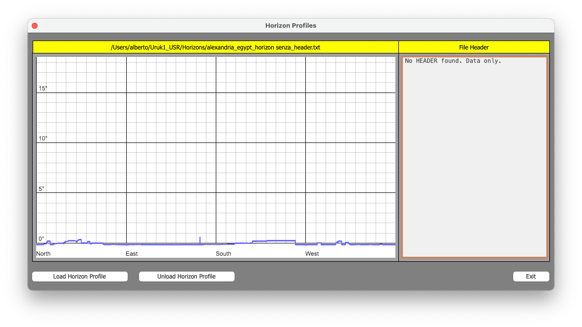
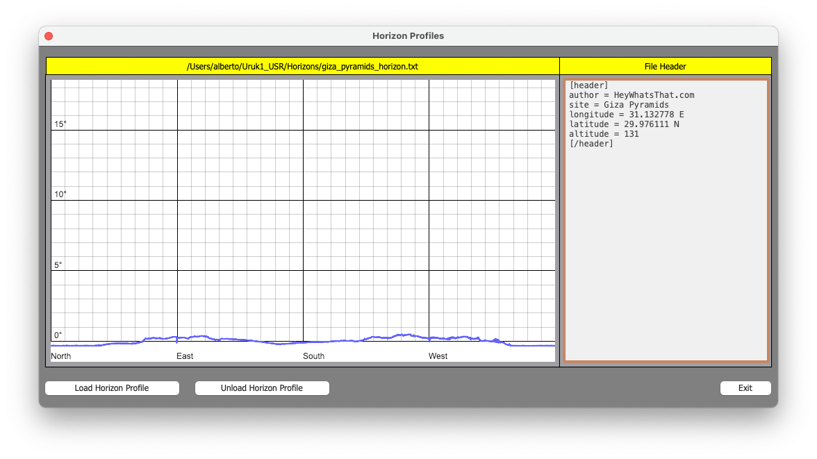
Every location of archeoastronomical interest has its natural obstacles like mountains, hills, etc. Presumably their position hasn’t changed over the centuries, and their presence has the effect to modify the local horizon in terms of sunrise, sunset and so on. Basically all we need is a series of coordinates [azimuth, altitude] relative to these obstacles, the more they are and better the true profile of the local horizon is defined. One has two options: go to the site, arm himself with patience and by means of a theodolite take all the needed measurements (a tedious and not always feasible task) or use some software generating this data thanks to satellites and the good old Space Shuttle.
I’ve found this site, http://www.heywhatsthat.com, that can generate horizon profiles readable from Stellarium. Actually I don’t like that three files are created, so with a little modification we can have a file perfectly readable by Uruk_One. Generating a New Panorama with this site is pretty simple (careful with the altitude value, though) so I assume you have already done it. Now, at the top right of the page click “In Stellarium” and then “Download horizon for Stellarium”. A file “stellarium-landscape.zip” will be downloaded. Once unzipped we’ll have a folder containing three files:
gazetteer.en.utf8 (contains info about mountains visible from the site)
horizon.txt (data file, azimuth and altitude)
landscape.ini (info about the site)
Now two options are available:
1) Rename the file horizon.txt using the site name, for example Giza_pyramids.txt and move it into the Uruk_One’s USER_PATH/Horizons. This will be directly readable by Uruk_One.
2) After renaming the TXT file add optionally some info taken from the other two files. Open the TXT file with a text editor and add BEFORE THE DATA a section like this:
[header]
name = Giza Pyramids
author = HeyWhatsThat.com
latitude=29.976111
longitude=31.132778
altitude=131
[/header]
0.0625 -0.312886
0.1875 -0.317088
0.3125 -0.314271
0.4375 -0.317173
............................
............................
The use of [header] and [/header] is mandatory, what you place in between will be used just for information. Feel free to use the info you want, included data about visible mountains for example. Both the options will produce a file readable from Uruk_One.
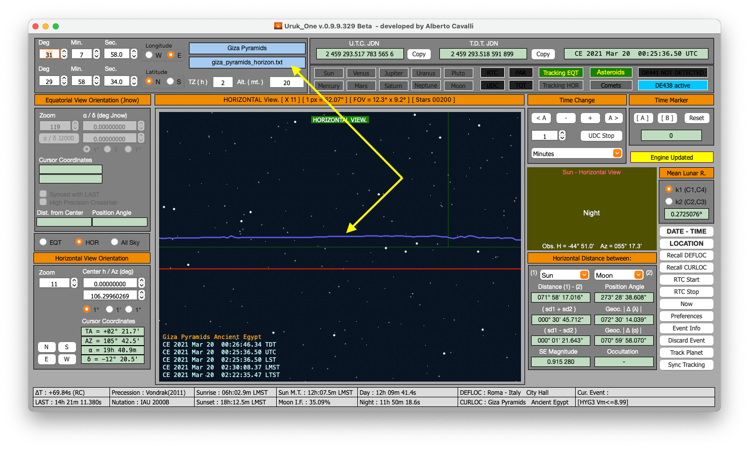
Let’s see some image now.

Hi
That was a quick update !
Regarding the location of the Observatories : Paris Observatory is listed twice. One is the Observatory located in Paris (48° 50′ 11″ N, 2° 20′ 14″ E, 67 m instead of 5 m), the other is Meudon Observatory (2° 13′ 40″ E, 48° 48′ 36″ N, 162 m). In fact these are 2 of the 3 observatories related to OBSPM (Observatoire de Paris Meudon, the other one is Nancay radiotelescope).
Now the time display is correct : 14:59:00, 15:00:00, 15:01:00.
DST is now working.
I check the new horizon profile option following your instructions: I have downloaded the file Tour Eiffel and I copy the file in the Uruk1_USR/Horizons/Tour Eiffel. The new horizon profile is now visible on the horizon map. So everything is working fine.
Best regards
Hi,
yup, quick because the DST bug couldn’t stay there 🙂
The history of the Paris Observatory looks similar to the fate of Rome. Technically useless, it is now the headquarters of INAF (National Institute of Astrophysics) and the scientific activity has been moved to two sites that are hundreds of kilometers apart but suitable for instrumental activity. Should I mention Meudon and Nancy only?
At the moment the selected Horizon Profile is “forgotten” when you get out the application, but since I am going to rework the locations archive I will add the possibility to link the horizon profile file with the location itself, in order to upload both together. Also I need a user file placed in the USER_PATH which remains after each application update.
Regards.
Hi
Unlike in other countries (i.e. Old Greenwich Observatory), Paris Observatory in Paris is a very busy place I visit quite often. In the Old building is located the main Observatory Library and the atomic clock of the Time department. In a new building only a few meters away, hundred of astronomers, researchers and students are working (IMCCE is located here). In Meudon, other astronomers use telescopes and the famous solar tower. As Nancay (200 km south from Paris) is for radiotelescope observations only, I think it is a good idea to mention Paris and Meudon in the location database for historical research.
Nice to link horizon profile to location.
Regards
Buonasera.
Ho visionato gli aggiornamenti con la nuova versione (0.9.9.330R) e gli interessanti sviluppi relativi ai profili degli orizzonti, che qualche tempo fa le avevo richiesto. E’ senz’altro un ottimo lavoro e complessivamente il software è di alto livello per le ricerche in campo archeoastronomico. Seguirò con interesse gli sviluppi degli aggiornamenti.
Cordiali saluti
La ringrazio del commento positivo. Ho anche pubblicato un post dove metto alla prova il profilo orizzonte del mio sito e sembrerebbe sufficientemente affidabile. Da quello che ho notato è preferibile fidarsi della quota proposta dal generatore e riferirsi a un paio di metri sopra di questa piuttosto che inserire l’altitudine assoluta sopra il livello del mare.
Coridali Saluti.